TerraExplorerExtentions
Imagery Layer extension:
The Imagery Layer extension allows you to drape unlimited size satellite/aerial image files on your base terrain database. Using the Imagery Layer object you can instantly add new pieces of terrain images or update your project with the most updated images. You can add as many Imagery Layers to your project and show/hide each one at any point. The Imagery Layer object support the most common multi-resolution file formats (e.g. MrSid, ECW, Skyline's MPT/MPU). Any TerraExplorer viewer can display Imagery Layers added to the project.
Video on Terrain extension:
The Video on Terrain extension allows you add live or recorded video streams, captured by static or moving cameras, on the terrain. The video is projected on the terrain according to the position of the camera and the lens filed of view. In case the camera is moving (e.g. video from UAV) the Video object display each frame in a position according to the telemetry information.
Terrain Extractor extension:
Extract Terrain to MPT:
The Terrain Extractor to MPT tool allows you to cut and download a subset of a local or remote MPT database to you local machine. Using the Terrain Extractor tool you can create a CD/DVD size terrain databases for distribution or even create a local MPT from a DirectConnect project. The extracted terrain is been built from a high-resolution polygon, a medium resolution rectangle surrounding the high-resolution area and a low-resolution area that always covers the entire terrain. You can control the size of the high- and medium-resolution areas and control the quality of all three areas.
Extract Terrain to VRML:
The Terrain Extractor to VRML tool allows you to cut and download a subset of a local or remote MPT database and buildings to you local machine as VRML model. This tool was optimized for 3D printing using ZCorp 3D printers and can also be used with any VRML viewer.
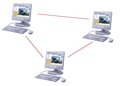
Collaboration extension :
The Collaborative Environment extension allows the user to fly jointly with other TerraExplorer users across a limited bandwidth TCP/IP framework. Users can lead, follow in real-time, interactive TerraExplorer Fly-through sessions, chat with other users, mark up areas on the terrain and toggle information layers for further analysis. The TerraExplorer Collaboration tool also optionally works with a Collaboration extension to the TerraGate server for an enterprise collaboration environment.
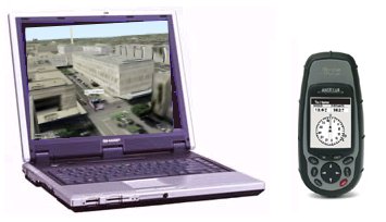
GPS Tracking:
Control the movement of one or more objects by reading live or recorded GPS information using the NMEA protocol. You can select to attach the GPS locations to any TerraExplorer object and optionally include trace lines to mark the object location history. The GPS Tracking tool reads the tracking information directly from a GPS or communication device through a USB or COM port or from a local or remote file. The GPS tool supports multiple entities in a single device, and allows fast forwarding capabilities when reading recorder information.
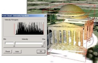
Point Cloud extention:
The Point Cloud extension allows you to add and edit a pre-processed point cloud model at any point in the 3D Terrain. These models are created from a list of points in a 3D area that are collected by various 3D scanners.
C2MP bundle:
A set of Command & Control and mission planning features for military and defense users. The extension includes the following tools:
- Collaboration tool
- GPS tool
- Terrain Extractor tool
- Mil-Std-2525 symbols creator
|  Se connecter

